WeatherWatcher: Snowy and cold week ahead
Monday, December 19, 2022
 |
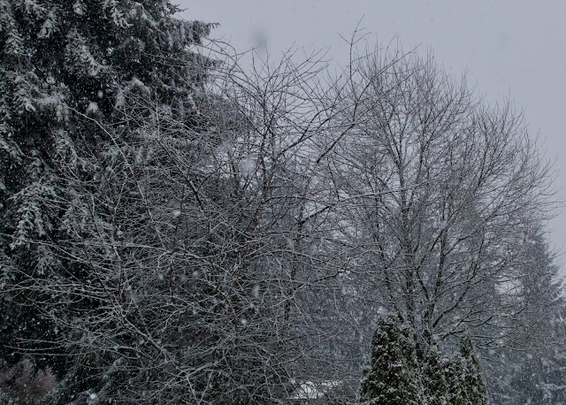
| Snow covered trees on December 18, 2022 Photo by Carl Dinse |
Some light snow arrived Sunday, December 18, 2022 just a couple hours later than it did 32 years ago, which was a far bigger storm.
As of 6pm Sunday evening about an inch of snow had accumulated at the Richmond Beach station.
Around the same time, the lower reaches of Lake Forest Park were bare, with rain falling. Higher up, in central Shoreline, there was also about an inch accumulation with snow still falling.
 |
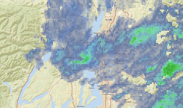
| Doppler Radar Sunday December 18, 2022 at 10:29pm National Weather Service in Seattle, Wa |
As of Sunday evening, at 10:29pm an active convergence zone centered over the King / Snohomish County line continues. Another 1-2 inches of snow is possible before the activity dies down by the early morning hours. Temperatures are expected to remain below freezing between Sunday evening and Thursday. There might be a brief warm up Tuesday afternoon into the mid-30's with a storm.
Forecast: Monday should be a cloudy, cold, but mostly dry day. A renewed slight chance of snow showers may show up late Monday night into Tuesday morning. Temperatures are expected to remain below freezing, reaching around 30-31°F for a high temperature, with lows in the lower to mid 20's.
Tuesday's storm: A storm west off the Pacific Ocean is expected to move in, with the center of the storm track just south of Seattle. Some models have it coming in south of Olympia. Either way, everyone on the north side of the storm track is expected to remain all snow and below freezing during this event.
There's a slight chance some warmer air might mix in up to even Everett for a very short time during the Tuesday storm which might make the snow heavier and wet, maybe with a few rain drops mixed in at times. This warm period is expected to be very short lived, maybe about an hour or so late in the afternoon.
Total snow accumulations from Tuesday's storm could be in the range of 3-10 inches depending on how far south this storm tracks. If it comes in closer to Seattle it could be higher amounts for those of us north of downtown Seattle.
Lows Tuesday night through Thursday night are expected to be in the low 20's, we could even reach the teens Wednesday morning.
Wednesday and beyond: We get a bit of a break Wednesday, but not from the cold. Any snow we receive will stick around for the remainder of the week. Another storm rolls in Thursday afternoon into Friday. At this time models think a transition will occur Friday with milder temperatures and rain with a possible atmospheric river though the holiday weekend.
Bottom line: Be prepared for a full week of winter conditions including accumulated snow on the ground. Next weekend at this time shows a shift to some above freezing rain but that could easily change over the next few days. We could be intermittently in and out of winter weather for the next several weeks through January.
There is a huge arctic air mass hanging out in Western Canada now that traveled over from Siberia last week. It is very cold, saturating the temperature charts at -58°F in places and even showing up on infrared satellites.
The arctic air mass is expected to be in Western Canada through next weekend and beyond so any storm that tracks south of Seattle could pull some of that air down into the Puget Sound region and keep us on the below freezing side with snow instead of rain.
For current weather conditions visit www.shorelineweather.com


0 comments:
Post a Comment