
WeatherWatcher: Active Convergence zone may bring slushy short-lived snowfall Saturday morning
Saturday, March 25, 2023
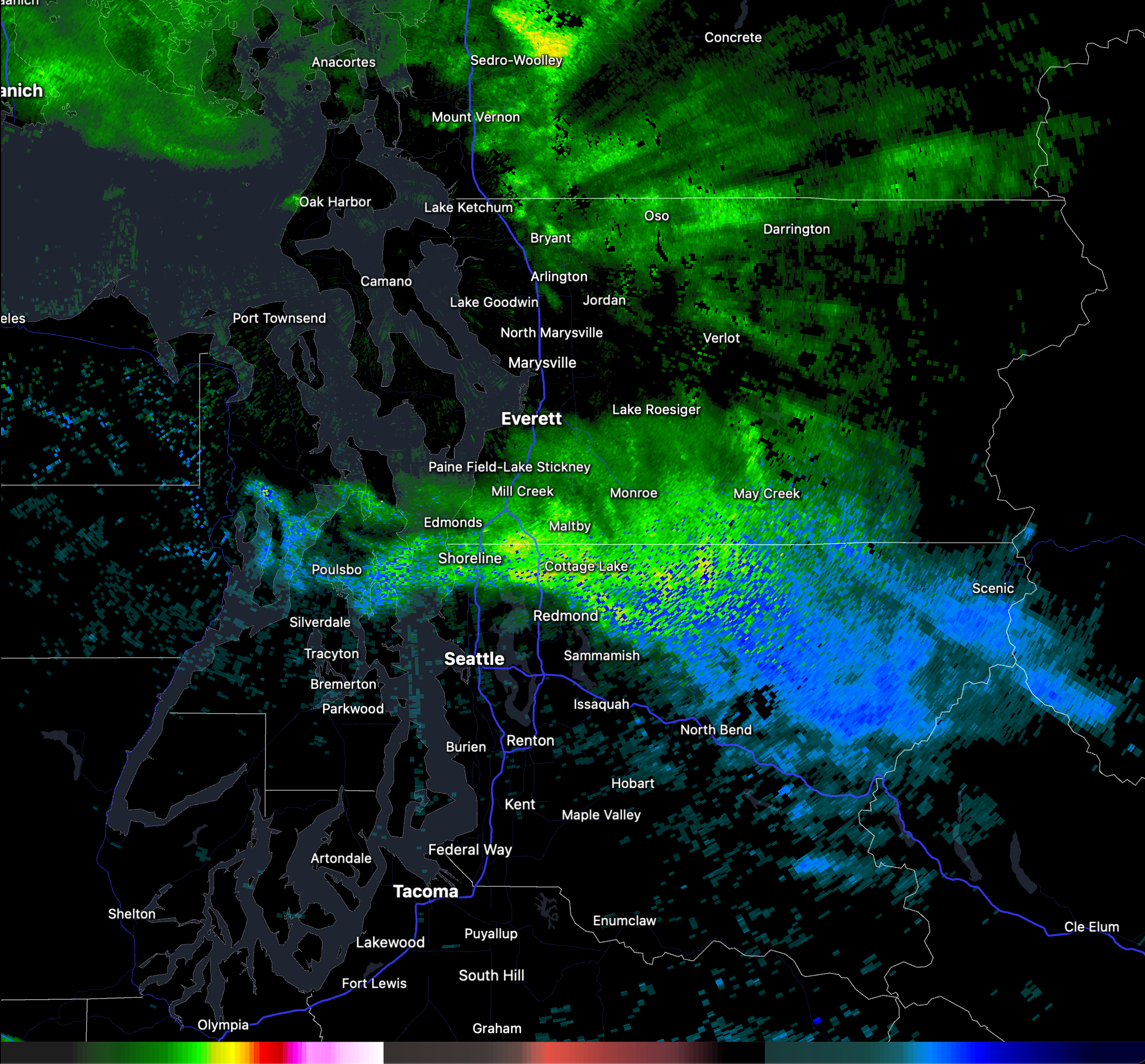 |
| Radar image at 11:57 PM PDT March 24, 2023. |
An active Puget Sound Convergence zone is in place centered right over Shoreline and Lake Forest Park, with an east/west spread. Radar as of 11:58pm Friday night is indicating some showers are heavy enough that they are turning over to snow in localized spots. In the above radar image, green is rain, pinks are rain/snow mix, and blue is snow.
Accumulations are not expected, but if we do get accumulation, it will likely be light, confined to grassy and other cold surfaces, and very short lived. Mostly we should just expect to see snowflakes falling with rain mixed in at times or just plain rain. If there is a full changeover to snow and it does start accumulating, it will be short lived. Daytime temperatures Saturday morning should easily rise above freezing and melt anything off as soon as precipitation ends.
There is also a slight chance of a thunderstorm with this convergence zone possible overnight into Saturday morning. Colder than normal weather continues through the weekend and next week. Another chance of snow mixing with rain is possible Sunday morning as well.
There is a break in the weather expected for Monday through Wednesday evening. Sunny skies and colder than normal temperatures. Highs in the 50's with lows in the mid to upper 30's. Chance of rain showers returns next Thursday.
For current weather conditions visit www.shorelineweather.com


0 comments:
Post a Comment